Guestuser: Login or enrol?
- Home
- Main Display
- Main Display (Old)
- Find a Walk
- Display INTRODUCTION
- DONATE
- Click below for your
profile & contributions
guestuser- News
- Tracks, Walks
- Challenge
- Community
- Lists & Logs
- Popular Lists:
- County Highpoints
- Range & Area Highpoints
- Local 100
- Highest Hundred
- Vandeleur-Lynams
- Arderins
- Carns
- Best rated
- Irish 900 up
- Irish Island
- Munros
- All Lists
- Shorter Irish
- County Highpoints
- Range & Area Highpoints
- Highest Hundred
- Local 100
- Local 100 (pre2014)
- Local Historical Cultural
- Best rated
- Irish 900 up
- Larger Irish
- Arderins
- Arderin Begs
- Arderins + Arderin Begs
- Vandeleur-Lynams
- Vandeleur-Lynams + Arderins
- Carns
- Binnions
- Highest 50 per Province
- Island Features
- Irish Island
- Coastal Hills
- Irish 600 up
- Irish 500 up
- British
- Munros
- British 600 up
- British 500-600
- British Marilyns
- Comprehensive
- All Irish summits
- All Irish features
- All British summits
- All Britain+ Ireland
- Special
- Analysis List
- Simple Irish Listings
- Simple Irish & British Listings
-
- More
- Motley Views
Welcome to MountainViews
If you want to use the website often please enrol (quick and free) at top right.OverviewFor more map options click on any overview map area or any detail map feature.Detail Map FeaturesFind Suggested Walks
Find hill, mountain, island, coastal feature.Videos


Users Online:
Guests online: 27Recent Contributions
 Get Notifications
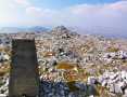
Silvermine Mountains East Top: East Top is Easy Top
Coppanagh: I'd go now if I were you.
Silvermine Mountains West Top: Fab hill
Dargle Gorge near Enniskerry, North Side.
Hell or high water
Bree Hill: Bree no longer a breeze
Rostrevor: Kilbroney Forest Park with description
Binn Chaonaigh: Havoc on the Maamturks!
Mount Kid: A small grassy hill top with amazing views towards the sea and beyond
Corraun Hill: Corraun at the double
Errisbeg Loop from Dog's Bay Beach
Knocknacloghoge: Viewed across Lough Dan
Conditions and Info
Use of MountainViews is governed by conditions and a privacy policy.
Read general information about the site.
Opinions in material here are not necessarily endorsed by MountainViews.
Hillwalking is a risk sport. Information in comments, walks, shared GPS tracks or about starting places may not be accurate for example as regards safety or access permission. You are responsible for your safety and your permission to walk.
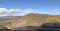
See the credits and list definitions.Video displayKerry Islands AreaPlace count in area: 74, OSI/LPS Maps: 63, 70, 71, 78, 83, 84, 85, EW-DC, EW-DE, EW-DW
Highest place: Beginish, 64m
Places in area Kerry Islands:Abbey Island 46.5mCarrigduff 53mFoze Rock Small 5mFoze Rock Great 10mBeginish (2) 64mBeginish (1) 14mBird Island 5mBrown Island 5mBurned Island 15mBurnt Island 11mCammarna 5mCappanacush 15mLemon Rock 5mCarrig Island 6mHog's Head 37mChurch Island 5mDaniel's Island 11mDoonagaun Island 5mDunkerron Island East 15mDunkerron Island West 15mEinaun Island 15mFlax Island 5mFox Island (2) 5mGarinish Island (1) 35mGreenane 5mHorse Island (4) 19mHorse Island (5) 42mIllaunacummig 11mIllaunakilla 5mIllaunanandan 13mIllaunanoon 5mIllaunboe 12mIllaundrane 17mIllauneeragh (2) 5mIllaungowla 5mIllaunimmil 22mIllaunleagh (1) 12mIllaunleagh (2) 5mIllaunleama 5mIllaunloughan 5mIllaunnakeesha 5mIllaunnanoon 5mIllaunnaweelaun 27mIllaunreanageah 5mIllaunroe (2) 5mIllaunsillagh 14mIllaunslea 5mIllauntannig 15mIllaunturlogh 15mInishkeelaghmore 15mInishkeragh 9mInishtooskert (1) 16mLamb's Island 15mLamb's Island (1) 15mLamb's Island 35mLeaghcarrig 5mLeaghillaun 5mLure 50mLong Island (1) 25mMoylaun Island 22mMucklaghbeg 5mOats Island 5mIllaunathowe 5mTwo Headed Island 28mOrmond's Island 15mPig Island (2) 5mReennafardarrig 15mRossdohan Island 35mRossmore Island 32mSamphire Island 22mSamphire Island Little 8mSherky Island 36mSpanish Island (1) 5mWasherwoman Rock 5m
Note: this list of places includes island features such as summits, but not islands as such.
Kerry County in Munster Province, in Irish Islands List
Landing grid ref.: V79500 65200
Reachable "On Foot " YHeight: 15m OS 1:50k Mapsheet: 84 Grid Reference: V79700 65200
Place visited by 4 members. Recently by: Fergalh, markmjcampion, Taisce, chelman7Island visited by 4 members. I have visited this place: NO (You need to be a logged-in member to change this.)I have visited this island: NO (You need to be a logged-in member to change this.)Longitude: -9.745639, Latitude: 51.826644 , Easting: 79700, Northing: 65200
ITM: 479676 565263 , GPS IDs, 6 char: OrmnIs, 10 char: OrmndsIsln
Linkback: https://new.mountainviews.ie/island/2456/COMMENTS for Ormond's Island (Oileán Urumhan) 1 of 1
Follow this place's comments
Height layer: © MapTiler

MountainViews.ie, a Hill-walking Website for the island of Ireland. 2500 Summiteers, 1480 Contributors, maintainer of lists such as: Arderins, Vandeleur-Lynams, Highest Hundred, County Highpoints etc
 Leatra
 chelman7
 Leatra
 simon3
 Colin Murphy
 chelman7
 jackill
 Colin Murphy
 melohara
 Visit our Facebook page.