Guestuser: Login or enrol?
- Home
- Main Display
- Main Display (Old)
- Find a Walk
- Display INTRODUCTION
- DONATE
- Click below for your
profile & contributions
guestuser- News
- Tracks, Walks
- Challenge
- Community
- Lists & Logs
- Popular Lists:
- County Highpoints
- Range & Area Highpoints
- Local 100
- Highest Hundred
- Vandeleur-Lynams
- Arderins
- Carns
- Best rated
- Irish 900 up
- Irish Island
- Munros
- All Lists
- Shorter Irish
- County Highpoints
- Range & Area Highpoints
- Highest Hundred
- Local 100
- Local 100 (pre2014)
- Local Historical Cultural
- Best rated
- Irish 900 up
- Larger Irish
- Arderins
- Arderin Begs
- Arderins + Arderin Begs
- Vandeleur-Lynams
- Vandeleur-Lynams + Arderins
- Carns
- Binnions
- Highest 50 per Province
- Island Features
- Irish Island
- Coastal Hills
- Irish 600 up
- Irish 500 up
- British
- Munros
- British 600 up
- British 500-600
- British Marilyns
- Comprehensive
- All Irish summits
- All Irish features
- All British summits
- All Britain+ Ireland
- Special
- Analysis List
- Simple Irish Listings
- Simple Irish & British Listings
-
- More
- Motley Views
Welcome to MountainViews
If you want to use the website often please enrol (quick and free) at top right.OverviewFor more map options click on any overview map area or any detail map feature.Detail Map FeaturesFind Suggested Walks
Find hill, mountain, island, coastal feature.Videos


Recent Contributions
 Get Notifications
Silvermine Mountains East Top: East Top is Easy Top
Coppanagh: I'd go now if I were you.
Silvermine Mountains West Top: Fab hill
Dargle Gorge near Enniskerry, North Side.
Hell or high water
Bree Hill: Bree no longer a breeze
Rostrevor: Kilbroney Forest Park with description
Binn Chaonaigh: Havoc on the Maamturks!
Mount Kid: A small grassy hill top with amazing views towards the sea and beyond
Corraun Hill: Corraun at the double
Errisbeg Loop from Dog's Bay Beach
Knocknacloghoge: Viewed across Lough Dan
Conditions and Info
Use of MountainViews is governed by conditions and a privacy policy.
Read general information about the site.
Opinions in material here are not necessarily endorsed by MountainViews.
Hillwalking is a risk sport. Information in comments, walks, shared GPS tracks or about starting places may not be accurate for example as regards safety or access permission. You are responsible for your safety and your permission to walk.
See the credits and list definitions.Video displayCaha Mountains Area N: Coomnadiha SubareaPlace count in area: 58, OSI/LPS Maps: 83, 84, 85, 88
Highest place: Hungry Hill, 682m
Maximum height for area: 682 metres, Maximum prominence for area: 400 metres,
Places in area Caha Mountains:
Cen: Hungry Hill:Coombane 510mDerryclancy 554mHungry Hill 682m
Cen: Knockowen:Cushnaficulla 596.9mGlenkeel Top 417mKnockastumpa 398mKnockeirky 579.7mKnockeirky South Top 522.5mKnockowen 660.3mStookeennalackareha 412m
E: Glengarriff:Derrynafulla SW 375mGowlbeg Mountain 362mNareera 530mNareera North Top 503mNareera South-West Top 505mShrone Hill 283mSugarloaf Mountain 574mSugarloaf Mountain Far West Top 560mSugarloaf Mountain West Top 565m
N: Coomnadiha:Baurearagh Mountain 489mCaha Far SE Top 555mCaha SE Top 585mCoomnadiha 644mCoomnalack Top 435mCummeenbaun 510mDroppa 522mKillane Mountain 537mKillane Mountain South-West Top 533mKnockagarrane 414mKnockreagh 499.1m
N: Knockeirka:Barraduff Mountain 400mKillaha Mountain 400mKnockeirka 426m
N: Knocknagorraveela:Derrysallagh 410mFeorus East 474mKnocknagorraveela 507mKnocknagorraveela NE Top 464m
N: Lauragh:Knockanoughanish 386mKnockatee 330m
S: Castletownbere:Disert 205mKnockanallig (Bear Island) 267m
W: Ardgroom:Derryvour Hill 160m
W: Eskatarriff:Coomacloghane 598.9mEskatarriff 600.5mEskatarriff East Top 532.7mKeeragh Mountain 363.2mKnocknaveacal North Top 512.7mKnocknaveacal South Top 512.7mLackabane 603mTooreenbaha 408.7mTooreennamna 524mTooth Mountain 592m
W: Knocknagree:Knocknagree 586mKnocknagree East Top 461mKnocknagree SE Top 442mLackawee 572mMaulin 621mMaulin North Top 579m
Note: this list of places includes island features such as summits, but not islands as such.
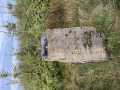
(Ir. An Cnoc Riabhach [OSI], 'the grey/brindled hill') Kerry County in Munster Province, in Carn List, Purple & green sandstone & siltstone Bedrock
Height: 499.1m OS 1:50k Mapsheet: 84 Grid Reference: V82704 61329
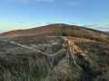
Place visited by 68 members. Recently by: farmerjoe1, srr45, nupat, NualaB, jackos, Nailer1967, Ianhhill, maoris, Superterence, osullivanm, mountainmike, Taisce, chelman7, annem, learykidI have visited this place: NO (You need to be a logged-in member to change this.)Longitude: -9.70077, Latitude: 51.792518 , Easting: 82705, Northing: 61330 Prominence: 66m, Isolation: 1.4km
ITM: 482680 561394 , GPS IDs, 6 char: Knckrg, 10 char: Knockreagh
Bedrock type: Purple & green sandstone & siltstone, (Caha Mountain Formation)
Knockreagh is the 574th highest place in Ireland.
Linkback: https://new.mountainviews.ie/summit/456/COMMENTS for Knockreagh (An Cnoc Riabhach) 1 2 Next page >>
Follow this place's comments
Height layer: © MapTiler

MountainViews.ie, a Hill-walking Website for the island of Ireland. 2500 Summiteers, 1480 Contributors, maintainer of lists such as: Arderins, Vandeleur-Lynams, Highest Hundred, County Highpoints etc
 Leatra
 chelman7
 Leatra
 simon3
 Colin Murphy
 chelman7
 jackill
 Colin Murphy
 melohara
 Visit our Facebook page.