Guestuser: Login or enrol?
- Home
- Main Display
- Main Display (Old)
- Find a Walk
- Display INTRODUCTION
- DONATE
- Click below for your
profile & contributions
guestuser- News
- Tracks, Walks
- Challenge
- Community
- Lists & Logs
- Popular Lists:
- County Highpoints
- Range & Area Highpoints
- Local 100
- Highest Hundred
- Vandeleur-Lynams
- Arderins
- Carns
- Best rated
- Irish 900 up
- Irish Island
- Munros
- All Lists
- Shorter Irish
- County Highpoints
- Range & Area Highpoints
- Highest Hundred
- Local 100
- Local 100 (pre2014)
- Local Historical Cultural
- Best rated
- Irish 900 up
- Larger Irish
- Arderins
- Arderin Begs
- Arderins + Arderin Begs
- Vandeleur-Lynams
- Vandeleur-Lynams + Arderins
- Carns
- Binnions
- Highest 50 per Province
- Island Features
- Irish Island
- Coastal Hills
- Irish 600 up
- Irish 500 up
- British
- Munros
- British 600 up
- British 500-600
- British Marilyns
- Comprehensive
- All Irish summits
- All Irish features
- All British summits
- All Britain+ Ireland
- Special
- Analysis List
- Simple Irish Listings
- Simple Irish & British Listings
-
- More
- Motley Views
Welcome to MountainViews
If you want to use the website often please enrol (quick and free) at top right.OverviewFor more map options click on any overview map area or any detail map feature.Detail Map FeaturesFind Suggested Walks
Find hill, mountain, island, coastal feature.Videos
(none available)Users Online:
Guests online: 26Recent Contributions
 Get Notifications
Silvermine Mountains East Top: East Top is Easy Top
Coppanagh: I'd go now if I were you.
Silvermine Mountains West Top: Fab hill
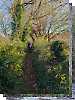
Dargle Gorge near Enniskerry, North Side.
Hell or high water
Bree Hill: Bree no longer a breeze
Rostrevor: Kilbroney Forest Park with description
Binn Chaonaigh: Havoc on the Maamturks!
Mount Kid: A small grassy hill top with amazing views towards the sea and beyond
Corraun Hill: Corraun at the double
Errisbeg Loop from Dog's Bay Beach
Knocknacloghoge: Viewed across Lough Dan
Conditions and Info
Use of MountainViews is governed by conditions and a privacy policy.
Read general information about the site.
Opinions in material here are not necessarily endorsed by MountainViews.
Hillwalking is a risk sport. Information in comments, walks, shared GPS tracks or about starting places may not be accurate for example as regards safety or access permission. You are responsible for your safety and your permission to walk.
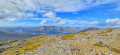
See the credits and list definitions.Video displayOrkney Islands Area Hoy (Orkney) SubareaPlace count in area: 18,
Highest place: Ward Hill, 481m
Maximum height for area: 481 metres, Maximum prominence for area: 481 metres,
Places in area Orkney Islands:
Eday:Ward Hill (Eday) 102m
Gairsay:Ward of Gairsay 102m
Hoy (Orkney):Cuilags 435mKnap of Trowieglen 399mOld Man of Hoy 137mThe Berry 199mWard Hill 481m
Orkney Mainland:Greeny Hill 153mHill of Miffia 158mKeelylang Hill 221mMid Hill 275mMilldoe - Mid Tooin 224mVestra Fiold 129mWideford Hill 225m
Rousay:Blotchnie Fiold 250mKierfea Hill 235m
South Ronaldsay:Ward Hill (S. Ronaldsay) 119m
Westray:Fitty Hill 169m
Note: this list of places includes island features such as summits, but not islands as such.
Height: 137m OS 1:50k Mapsheet: 7 Grid Reference: HY17600 00700
Place visited by 2 members. Recently by: rhw, bryanjbarryI have visited this place: NO (You need to be a logged-in member to change this.)Longitude: -3.431263, Latitude: 58.885705 , Easting: 317600, Northing: 1000700 Prominence: 122m, Isolation: 4.3km , GPS IDs, 6 char: Old137, 10 char: OldMnfHy
Linkback: https://new.mountainviews.ie/summit/B4927/COMMENTS for Old Man of Hoy 1 of 1
Follow this place's comments
Height layer: © MapTiler

MountainViews.ie, a Hill-walking Website for the island of Ireland. 2500 Summiteers, 1480 Contributors, maintainer of lists such as: Arderins, Vandeleur-Lynams, Highest Hundred, County Highpoints etc
 Leatra
 chelman7
 Leatra
 simon3
 Colin Murphy
 chelman7
 jackill
 Colin Murphy
 melohara
 Visit our Facebook page.
