- Home
- Main Display
- Main Display (Old)
- Find a Walk
- Display INTRODUCTION
- DONATE
- Click below for your
profile & contributions
guestuser- News
- Tracks, Walks
- Challenge
- Community
- Lists & Logs
- Popular Lists:
- County Highpoints
- Range & Area Highpoints
- Local 100
- Highest Hundred
- Vandeleur-Lynams
- Arderins
- Carns
- Best rated
- Irish 900 up
- Irish Island
- Munros
- All Lists
- Shorter Irish
- County Highpoints
- Range & Area Highpoints
- Highest Hundred
- Local 100
- Local 100 (pre2014)
- Local Historical Cultural
- Best rated
- Irish 900 up
- Larger Irish
- Arderins
- Arderin Begs
- Arderins + Arderin Begs
- Vandeleur-Lynams
- Vandeleur-Lynams + Arderins
- Carns
- Binnions
- Highest 50 per Province
- Island Features
- Irish Island
- Coastal Hills
- Irish 600 up
- Irish 500 up
- British
- Munros
- British 600 up
- British 500-600
- British Marilyns
- Comprehensive
- All Irish summits
- All Irish features
- All British summits
- All Britain+ Ireland
- Special
- Analysis List
- Simple Irish Listings
- Simple Irish & British Listings
-
- More
- Motley Views
Welcome to MountainViews
If you want to use the website often please enrol (quick and free) at top right.OverviewFor more map options click on any overview map area or any detail map feature.Detail Map FeaturesShowing 19 of a total of 28 items:
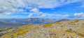
Purple Mountain 832m, Shehy Mountain 762m, Purple Mountain NE Top 757m, Tomies Mountain 735m, Cnoc an Bhráca 728m, Cnoc na dTarbh 655m, Tomies Mountain North Top 568m, Strickeen 440m, Eagles Nest 334m,Tracks:4112, 25km 4371, 21km 2138, 18km 2100, 17km 5102, 17km 2221, 16km 4702, 16km 3213, 16km 2560, 16km 2084, 14km Find Suggested Walks
Find hill, mountain, island, coastal feature.Videos


Users Online:
Guests online: 25Recent Contributions
 Get Notifications
Silvermine Mountains East Top: East Top is Easy Top
Coppanagh: I'd go now if I were you.
Silvermine Mountains West Top: Fab hill
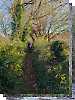
Dargle Gorge near Enniskerry, North Side.
Hell or high water
Bree Hill: Bree no longer a breeze
Rostrevor: Kilbroney Forest Park with description
Binn Chaonaigh: Havoc on the Maamturks!
Mount Kid: A small grassy hill top with amazing views towards the sea and beyond
Corraun Hill: Corraun at the double
Errisbeg Loop from Dog's Bay Beach
Knocknacloghoge: Viewed across Lough Dan
Conditions and Info
Use of MountainViews is governed by conditions and a privacy policy.
Read general information about the site.
Opinions in material here are not necessarily endorsed by MountainViews.
Hillwalking is a risk sport. Information in comments, walks, shared GPS tracks or about starting places may not be accurate for example as regards safety or access permission. You are responsible for your safety and your permission to walk.
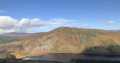
See the credits and list definitions.Video displayDavid-Guenot: Track 3213 in area near Purple Mountain, Purple Mountain (Ireland)Purple Mountain Loop Length: 16.0km, Creator time taken: 5h57m, Ascent: 951m,
Descent: 1018m
Places: Start at V8806388812, Purple Mountain, Purple Mountain NE Top, Shehy Mountain, Tomies Mountain, Tomies Mountain North Top, end at Start
Logged as completed by 6
 COMMENTSNo comments uploaded yet.
NOTE: ALL information such as Ascent, Length and Creator time taken etc should be regarded as approximate. The creator's comments are opinions and may not be accurate or still correct.
Your time to complete will depend on your speed plus break time and your mode of transport. For walkers: Naismith's rule, an approximate though often inaccurate estimate, suggests a time of 4h 47m + time stopped for breaks
NOTE: It is up to you to ensure that your route is appropriate for you and your party to follow bearing in mind all factors such as safety, weather conditions, experience and access permission.
* Note: A GPS Height in the elevation profile is sourced from the device that recorded the track. An "SRTM" height is derived from a model of elevations for parts of the earth. More detail Height layer: © MapTiler

MountainViews.ie, a Hill-walking Website for the island of Ireland. 2500 Summiteers, 1480 Contributors, maintainer of lists such as: Arderins, Vandeleur-Lynams, Highest Hundred, County Highpoints etc
 Leatra
 chelman7
 Leatra
 simon3
 Colin Murphy
 chelman7
 jackill
 Colin Murphy
 melohara
 Visit our Facebook page.