Warning: Undefined variable $trackExportPanel in /var/www/vhosts/new.mountainviews.ie/httpdocs/mv/classes/display/RWD/trackSupportClass.php on line 1099 Walk in Ireland Knockanaguish Peakeen Mountain Peakeen Mountain West Top Peakeen Mountain North-West Top Peakeen Mountain Far NW Top, ascent 650m, length 12.4km
Cookies.
This website uses cookies, which are small text files that the website puts on your device to facilitate operation. Cookies help us provide a better service to you. They are used to track general user traffic information and to help the website function properly.
MountainViews is standardising on this new presentation style for the "Main Page". For a short while it is still possible to
Get the equivalent "old" page here. Or choose from the "Home" menu option above to change.
simon3: Track/3808 in area near Knockanaguish, Mangerton (Ireland)
All the Peakeens and Knockanaguish
Ascent: 650m,
Length: 12.4km,
Creator time taken: 6h42m
Descent: 680m,
Time predicted from Naismith's rule: 3h 33m + breaks
Click here to rate track
PlacesStart at Gowlane School Ruin V91732 75184, Knockanaguish, Peakeen Mountain, Peakeen Mountain West Top, Peakeen Mountain North-West Top, Peakeen Mountain Far NW Top, end at Start
Track Rating ..
[RWD version 1 ]
The start of this walk is at a point on the old Kenmare to Killarney road as others have described. There is parking for about 3 cars. Reaching the top of Knockanaguish is a relatively easy climb. The top area has a number of knolls and also a fine view towards Mangerton though this was somewhat misty on the occasion we were there.
L Nagannee has serious cliffs to left of pic.
Dropping back to the col before Peakeen requires some care. Go to the east side of Lough Nagannee which as you can see from the picture has cliffs above it. As others have said, take care here.
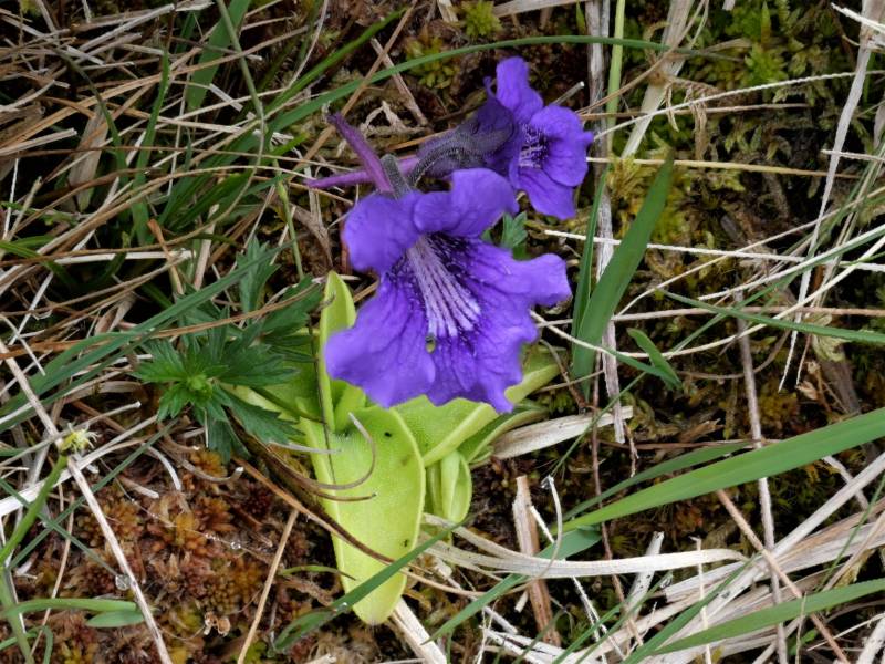
Common bogwort.
One gorgeous bog plant visible here and in much of the SW of Ireland is the Large-flowered Butterwort Pinguicula grandiflora. Look at the sticky leaves and you can see the insects that the plant catches for nutrients.
From the top of Peakeen towards its western tops and beyond the Dunkerrons.
The top of Peakeen is reached by threading a route through various crags. The view west over the minor western peaks of Peakeen and towards the Dunkerrons is superb. Boughill, Knocklomena etc line up with Mullaghanattin.
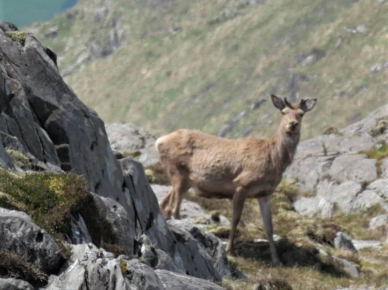
Various deer appeared sometimes in groups of up to five or six towards the north of Peakeen. This doe took a good and curious look for over a minute. Getting to the western peaks of Peakeen, so to speak, is an exercise in working your way through multiple obsctacles such as ravines and boggy land. When there there are some further interesting views for example this one of the big group of very remote high lakes to the north.
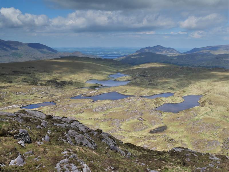
Glas Lough and various other remote lakes.
Return or should I say trudge back to the old road via the rough ground to the north of the Peakeens.
Editing Details for track/3808
NOTE: ALL information such as Ascent, Length and Creator time taken etc should be regarded as approximate. The creator's comments are opinions and may not be accurate or still correct.
Your time to complete will depend on the speed of the slowest plus break time and your mode of transport.
NOTE: It is up to you to ensure that your route is appropriate for you and your party to follow bearing in mind all factors such as safety, weather conditions, experience and access permission.
Uploaded on: Tue, 29 May 2018 (20:29:01), Linkback: https://new.mountainviews.ie/track/3808/
* Note: A GPS Height in the elevation profile is sourced from the device that recorded the track. An "SRTM" height is derived from a model of elevations for parts of the earth. More detail
Use of MountainViews is governed by conditions and a privacy policy.
Read general information about the site. Opinions in material here are not necessarily endorsed by MountainViews.
Hillwalking is a risk sport. Information in comments, walks, shared GPS tracks or about starting places may
not be accurate for example as regards safety or access permission. You are responsible for your safety and your permission to walk.
See the credits and list definitions.


 (Aug 2017) Click for player.")
 by mcrtchly Click for player.")
 Click for player.")


 Our Facebook page.