Warning: Undefined variable $trackExportPanel in /var/www/vhosts/new.mountainviews.ie/httpdocs/mv/classes/display/RWD/trackSupportClass.php on line 1099 Walk in Ireland Mullaghbane Carnanelly West Top Carnanelly, ascent 411m, length 7.9km
Cookies.
This website uses cookies, which are small text files that the website puts on your device to facilitate operation. Cookies help us provide a better service to you. They are used to track general user traffic information and to help the website function properly.
MountainViews is standardising on this new presentation style for the "Main Page". For a short while it is still possible to
Get the equivalent "old" page here. Or choose from the "Home" menu option above to change.
simon3: Track/4457 in area near Mullaghbane, Sperrin Mountains (Ireland)
Carnanelly bad weather route.
Ascent: 411m,
Length: 7.9km,
Creator time taken: 3h53m
Descent: 368m,
Time predicted from Naismith's rule: 2h 16m + breaks
Click here to rate track
PlacesStart at H64585 92874, Mullaghbane, Carnanelly West Top, Carnanelly, end at Start
Track Rating ..
[RWD version 1 ]
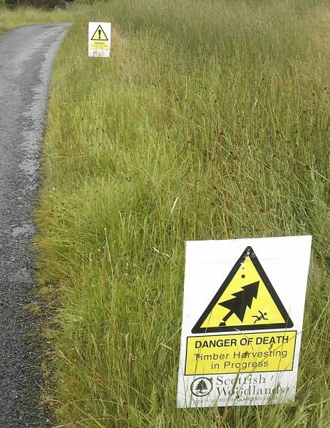
"Danger of Death"
This is an out and back route useful reaching the three ridge summits of Mullaghbane, Carnanelly West and Carnanelly which we used in bad weather. It starts from the cattle grid mentioned by gerrym at H 646927. The route is very straightforward an follows a fence the whole way. The day we did it there was extensive felling in the NE end of Glenlark forest with dire warnings about risk.
Route by fence.
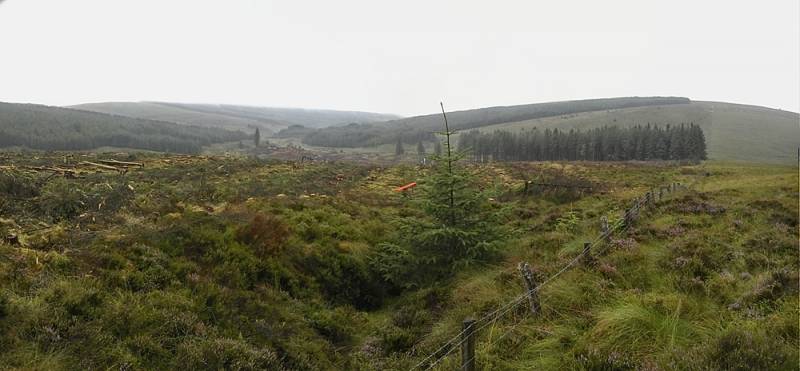
There were more or less no useful or interesting opportunities for photography on most of the route, however here is a picture of the felling as of mid August 2021. It would be possible to take various variations of this route usually for example returning differently through Glenlark forest but we didn't want to blunder round there while the extensive highly mechanised felling was taking place.
Extensive felling at NE of Glenlark Forest.
A useful route for a quick visit.
Editing Details for track/4457
NOTE: ALL information such as Ascent, Length and Creator time taken etc should be regarded as approximate. The creator's comments are opinions and may not be accurate or still correct.
Your time to complete will depend on the speed of the slowest plus break time and your mode of transport.
NOTE: It is up to you to ensure that your route is appropriate for you and your party to follow bearing in mind all factors such as safety, weather conditions, experience and access permission.
Uploaded on: Fri, 20 Aug 2021 (06:30:54), Linkback: https://new.mountainviews.ie/track/4457/
* Note: A GPS Height in the elevation profile is sourced from the device that recorded the track. An "SRTM" height is derived from a model of elevations for parts of the earth. More detail
Use of MountainViews is governed by conditions and a privacy policy.
Read general information about the site. Opinions in material here are not necessarily endorsed by MountainViews.
Hillwalking is a risk sport. Information in comments, walks, shared GPS tracks or about starting places may
not be accurate for example as regards safety or access permission. You are responsible for your safety and your permission to walk.
See the credits and list definitions.


 by gerrym Click for player.")
 by gerrym Click for player.")
 by gerrym Click for player.")
 by gerrym Click for player.")


 Our Facebook page.