Warning: Undefined variable $trackExportPanel in /var/www/vhosts/new.mountainviews.ie/httpdocs/mv/classes/display/RWD/trackSupportClass.php on line 1099 Walk in , ascent 1724m, length 44.1km
Cookies.
This website uses cookies, which are small text files that the website puts on your device to facilitate operation. Cookies help us provide a better service to you. They are used to track general user traffic information and to help the website function properly.
MountainViews is standardising on this new presentation style for the "Main Page". For a short while it is still possible to
Get the equivalent "old" page here. Or choose from the "Home" menu option above to change.
Ascent: 1724m,
Length: 44.1km,
Creator time taken: 31h 5m
Descent: 2973m,
Time predicted from Naismith's rule: 11h 41m + breaks
Click here to rate track
PlacesStart at Lon -3.30349, Lat 37.0132, end at Lon -3.26447, Lat 36.9988, 3.8km SE from Start
Track Rating ..
[RWD version 1 ]
This is a 2 day route in Sierra Nevada starting from Alto do Chorillo and ending in Trevelez. The route was some time in the planning, takes in 11 of the 3,000m mountains in Sierra Nevada and marks my completion of all 30 3,000m peaks in the range.
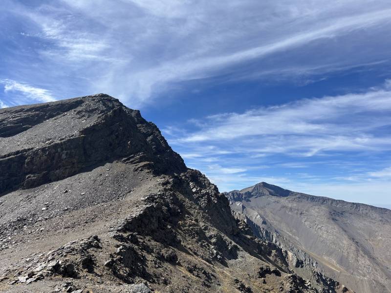
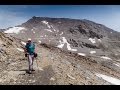
North face of Alcazaba with Mulhacen to the right
The ridge runs from Puntal de Goteron under Alcabaza to Picon Jerez - about 16k long, and is the most awkward section of the range to get at. These hills lack the height and attraction of the range's big three (Mulhacen, Veleta and Alcazaba) and are thus not served as well by mountain roads and starting points. While you could reach the ridge in one day, you were likely to have climbed around 1,700m and 4-5 hours just getting there which is a chunk out of the day. I decided that there was no real option but spending the night on the ridge, something which is way out of my comfort zone - the ridge rarely dips below 3,000m. Anyway despite prodigious spending in Ultralight Outdoor Gear and a procession of delivery vans to chez Onzy, my pack weighed 9kg before water and food. As I planned to carry 6 litres of water this was clearly going to be a physical challenge.
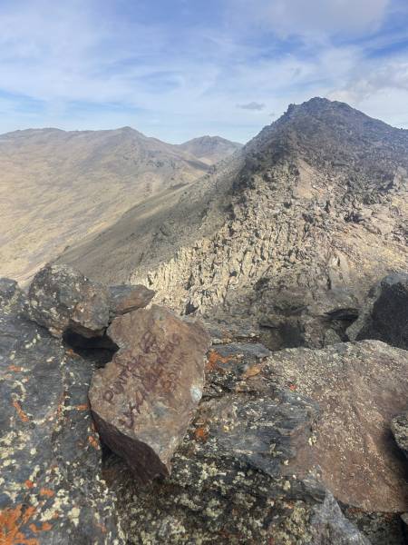
Using the tourist bus which serves visitors to Mulhacen landed me at 2,700m at Alto do Chorillo. From here I worked my way down to Laguna Hondera and around the Mulhacen/Alcazaba massif and onto the sunny ridge north of Alcazaba, close to my first target, Puntal de Goteron. From there the first two thirds of the ridge was very slow going, lots of broken rock and dead ends. The first 3 hills are within a kilometre, but this kilometre took me an hour and a half. Thankfully the fifth hill, Mojon Alto, was a detour off the main ridge which allowed me a half hour respite from the pack.
Puntal de los Calderetas
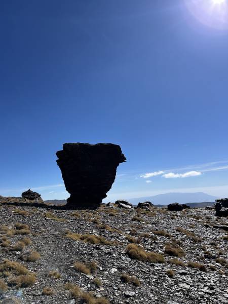
As the light started to fail, I looked for somewhere to 'pitch' my bivvy at an altitude of 3,100m. At this stage I was just past hill number 8, and the ground had become easier, but also barer and with less shelter... I was in the bag by 8pm and didn't emerge until 7.30am. About the night I will say nothing except that it was an experience I will never repeat - my bivvying days are over before they begun...
Rock formation on a col below the ridge
Day 2 was a very different one weatherwise - the wind had steadily increased all night and was now c.30kts. The sky had a red ominous hue, and the sun remained invisible. Still, I had broken the back of the walk - as well as one of my sticks - on day 1 and all that was left was to mop up the remaining three mountains, finishing on Cerro Pelado. The wind made this tough but these hills were far less craggy and much easier walking - for 2 of then I was also able to dump the pack.
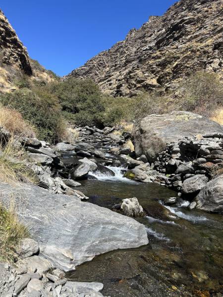
Trevelez Gorge on the descent
Following a short very steep descent to Laguna Juntillas I took stock - from here I had a 18k,1,600m descent through 2 distinct gorges formed respectively by the Rio Juntillas and the Rio Trevelez. The upper gorge in particular was tortuous, clearly not used much, only partially tracked and needing constant concentration on navigation, which meant either less speed, or more falling over...the second stick died around here. Eventually I emerged onto more travelled ground, although that is relative - this was a Sunday, and I saw no one at all on the descent until I reached Trevelez.
Great walk in great walking country.
Editing Details for track/5364
NOTE: ALL information such as Ascent, Length and Creator time taken etc should be regarded as approximate. The creator's comments are opinions and may not be accurate or still correct.
Your time to complete will depend on the speed of the slowest plus break time and your mode of transport.
NOTE: It is up to you to ensure that your route is appropriate for you and your party to follow bearing in mind all factors such as safety, weather conditions, experience and access permission.
Uploaded on: Wed, 1 Oct 2025 (17:27:25), Linkback: https://new.mountainviews.ie/track/5364/
* Note: A GPS Height in the elevation profile is sourced from the device that recorded the track. An "SRTM" height is derived from a model of elevations for parts of the earth. More detail
Use of MountainViews is governed by conditions and a privacy policy.
Read general information about the site. Opinions in material here are not necessarily endorsed by MountainViews.
Hillwalking is a risk sport. Information in comments, walks, shared GPS tracks or about starting places may
not be accurate for example as regards safety or access permission. You are responsible for your safety and your permission to walk.
See the credits and list definitions.


 Our Facebook page.