[RWD version 1 ]
A short walk of 2 hours with good parking, comfortable forest tracks, open hillside and far reaching views.
Starting point is at the eastern end of the magnificent Glenelly valley in the carpark for Goles Forest. This carpark and forest tracks have recently been upgraded, no doubt to facilitate further felling. It is a lonely spot but an adjacent cottage gives some comfort in leaving the car and i have never had any bother in my years of walking in the Sperrins.
Head through the gate into the forest passing a stream and then turning right over another stream. This is in an extensive area of clearfell, with tall trees higher up the hillside. Pass a firedam with a warning sign and a nursery of baby conifers looking up to their older relatives.
The track turns uphill on reaching the forest edge and enters the still standing trees. Views appear across to the part of the forest cut off by the main road and higher to Mullaghsallagh, Mullaghaneany and Meenard. At a little layby I heading down through the well spaced trees to the river which runs along the forest edge. The river sits in a sheltered ravine and can follow this as go uphill, though it is wet in places and there is easier walking on its crest.
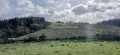
Steady uphill progess brings ever widening views across Glenelly to the big guns of Sawel and Dart. Also brought more of the fresh northery breeze which was coooling rather than cool and sharpened up the air to give clear views. The fence at the forest boundary eventually leaves the trees behind and crests at a rocky rise. A little further to the right (west) brought the summit area.
Backtrack east and drop slightly for the sizeable cairn at 550m. A great spot to laze awhile and soak up what the day may give. today i had views east to the high Antrim Hills with a prominent Slemish, past Slieve Gallion to Lough Neagh and the distant Mournes. South to Davanagh forest and a vigorous gorse fire. Westish to Cuilcaigh, Bluestacks and all the High Sperrins and north to Inishowen and Slieve Snaght! Oh and a little bit of pleasant sun!!
Continue east along forest boundary fence on pretty good ground, though could be alot wetter. The odd renegade tree had escaped over the fence onto the hillside, though some had been mercilessly cut down! The fence follows the forest as it heads back down into Glenelly and a broad track soon appears and makes for easy walking. This reaches a river following the forest edge and i dropped down to its side and followed until the forest track appeared. A pleasant walk back to the carpark then ensued. There are a number of blue barrels for feeding wildlife (as in Moydamlaght forest) but all were empty.


 by gerrym Click for player.")
 by gerrym Click for player.")
 by gerrym Click for player.")
 by gerrym Click for player.")


 Our Facebook page.